Led by the District Department of Transportation (DDOT), the Pennsylvania Avenue West streetscape project (Penn Ave West) seeks to improve travel for pedestrian, bicycle and vehicular traffic along this iconic corridor in the western portion of downtown DC.
Project Map
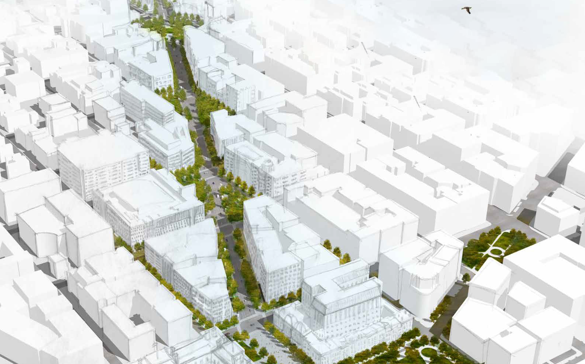
Pennsylvania Avenue West of the White House

The project area of Penn Ave West includes Pennsylvania Avenue, NW and its intersections between 17th and 22nd streets.
Often less touted than its well-known sister corridor to the east located between the White House and the U.S. Capitol, Penn Ave West is a vital connection for residents, commuters and tourists to neighborhoods including Foggy Bottom, Georgetown, Golden Triangle and DowntownDC. The corridor hosts several important public spaces, institutions and destination eateries in the District including Edward R Murrow Park, George Washington University, the World Bank, United Nations Foundation, Founding Farmers and District Commons to name a few. The corridor is also the pilot location for the District’s Smart Cities initiative.
Project Background
Creating a unique identity, sense of place, and respecting its place in history.
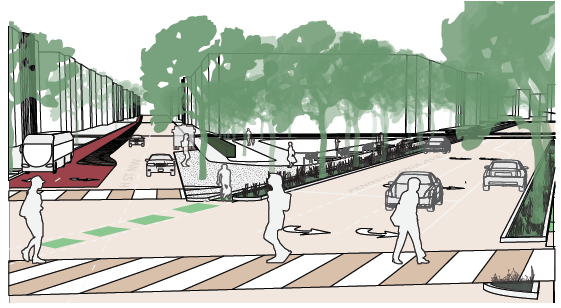
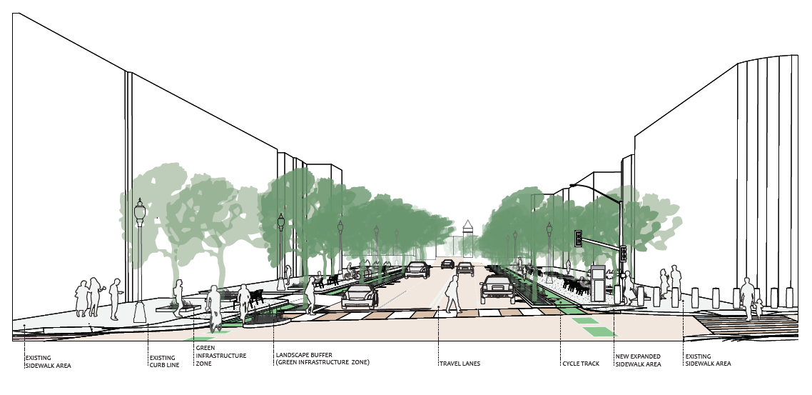
The goal of Penn Ave West is to improve pedestrian and bicycle travel while building a uniform and green streetscape that encourages opportunities for street activation.
The project will seek to meet the following objectives:
- Enhance the monumental corridor;
- Introduce dedicated multimodal amenities, like protected bike lanes;
- Improve the pedestrian experience;
- Safely connect destinations and neighborhoods for all users; and
- Enhance sustainability through the introduction of green infrastructure.

Frequently Asked Questions
What is the purpose of the Penn Ave West project?
The Penn Ave West project seeks to improve travel for pedestrian, bicycle, and vehicular traffic along Pennsylvania Avenue west of the White House.
How will I be able to provide input on the project as a person who lives and/or works in the area?
DDOT will be providing updates at ANC2A and ANC2B meetings and hosting public meetings to solicit feedback on the concept design. We also invite people to provide comments on the project website.
What are the limits of the work??
The Project area is bound by 17th and 22nd Streets, NW including key intersections like H and I Streets, NW.
What is the current status?
DDOT is refining the concept developed in the Downtown West Transportation Planning Study, based on survey and utility information. DDOT anticipates 30% design in fall 2019.